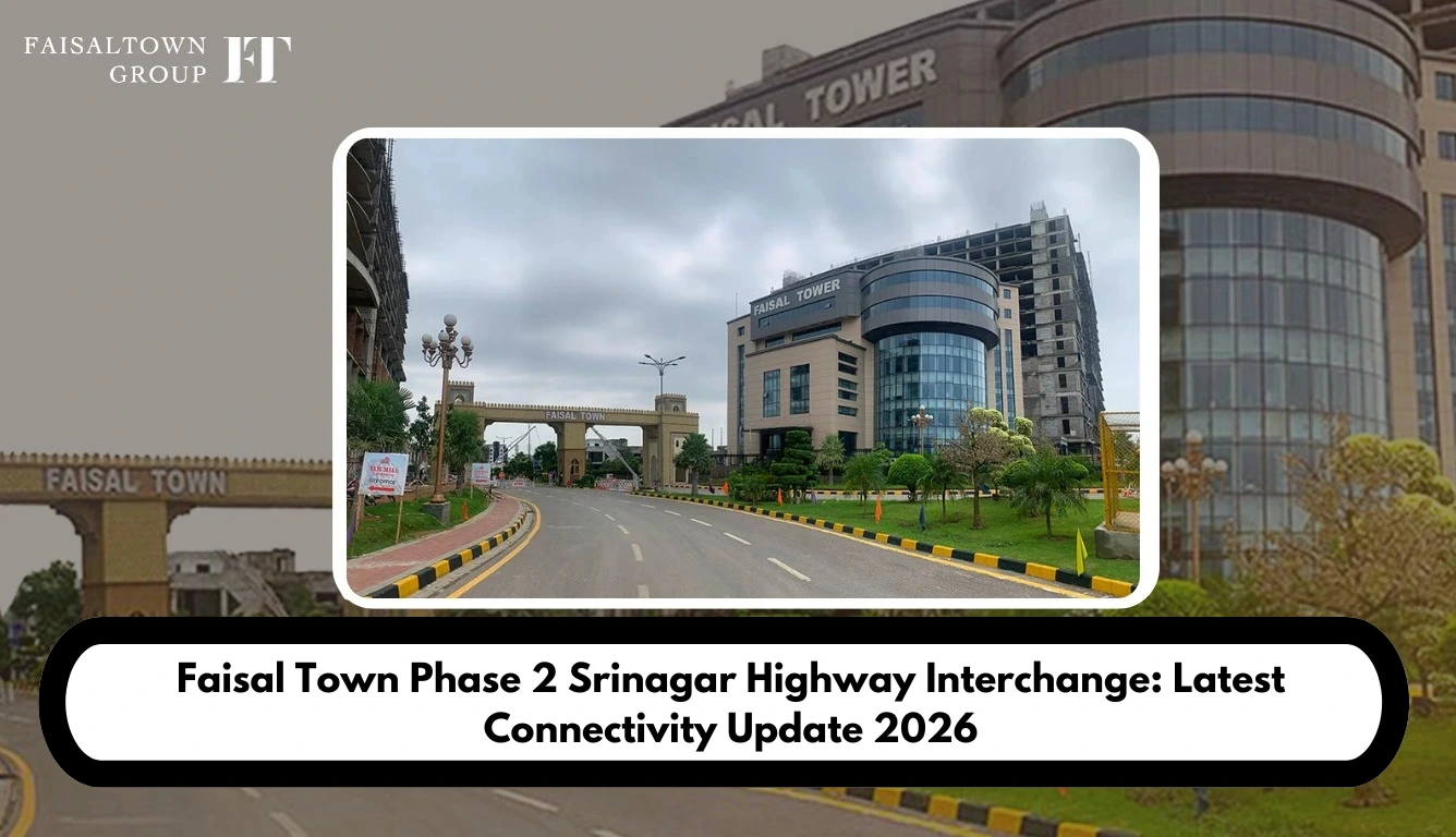
When buyers compare Faisal Town Phase 2 with other housing projects around Islamabad, road access almost always comes up early, right alongside price and possession. A highway can look close on a map and still mean nothing for daily life if there’s no straightforward way to actually get onto it. That gap between “nearby” and “usable” is what Faisal Town Connectivity really comes down to.
The Srinagar Highway matters here because it feeds into a much bigger chunk of Islamabad’s road network, the kind that would otherwise mean long detours through the city. Bring Faisal Town Islamabad and its surrounding access routes into that picture, and the question stops being about a line on a brochure. It becomes about an actual drive.
So here’s where the interchange currently stands, how it links to Faisal Town Phase 2 in practice, and what buyers should check before assuming anything about the commute.
What the Srinagar Highway Interchange Actually Does
Being close to a major road on paper and having a workable route to it are two different things. Entry and exit points matter. So does the condition of the connecting road, which way traffic naturally flows, and how far the project gate actually sits from the nearest usable access point.
A lot of buyers stop at “it’s near the highway” and leave it there. Road connectivity depends on the whole chain though, not just the closest point on a map.
This is also why two brochures for two completely different projects can both claim “minutes from the highway” and still describe very different realities. One phrase, two very different commutes, depending on what actually sits between the gate and the road.
What the Srinagar Highway Interchange Actually Does
An interchange lets traffic move between two major roads without stopping, turning, or cutting through local streets. Without one, a highway sitting right next to a housing project can still be maddening to reach.
You can live five minutes from a highway and still burn twenty minutes getting onto it if there’s no direct ramp nearby. Brochures rarely mention this part. Proximity looks good in a headline, but access is what actually decides the commute.
Where the interchange sits changes a lot downstream too, commuting patterns, how easily visitors find their way in, how commercial traffic moves, even how fast an ambulance could reach a house. A poorly placed interchange just doesn’t help as many people as one built closer to where residents actually live.
It’s also worth remembering that interchanges rarely get built in one go. Ramps, service roads, and signal-free crossings often come online in stages, so an interchange marked “operational” on a government notice might still be missing a few of the pieces that actually make it convenient for daily use.
Location and What Highway Access Really Looks Like
The chain looks roughly like this: project gate, then a connecting road, then the interchange, then the Srinagar Highway, and from there the wider network. Skip straight from “project” to “highway” and you’re missing most of what actually matters.
For residents, this should eventually mean fewer detours through congested city roads on the way toward central Islamabad or nearby motorway links. Airport runs, trips toward Rawalpindi, the regular back-and-forth into the city, all of it gets easier once the route is genuinely functional and not just marked on a plan. Worth checking the project’s master plan too, just to see how the internal roads tie into this bigger picture.
None of this is a done deal yet, though. Infrastructure timelines shift constantly in this market, and a route that looks finished on a map isn’t always finished on the ground.
Recent site visits reporting fast development inside the project are a reasonable sign that the internal groundwork is moving, but that’s a separate question from whether the external road connecting to the interchange has kept pace. Buyers sometimes assume the two move together. They don’t always.
Faisal Town Connectivity and Highway Access
Two projects can sit the exact same distance from a highway on a map and still deliver completely different commutes in real life. Usually it comes down to whether one has a proper connecting road and the other doesn’t.
Trace it yourself if you can. Start at the gate, follow the nearest connecting road, and see where it genuinely meets the interchange. The location page is a decent starting point, but honestly, nothing beats going and looking.
If you’re comparing options in the area, it also helps to look at how competing societies frame their own highway access. A piece like Faisal Town Phase 2 vs Capital Smart City is a useful read for exactly this reason, since connectivity claims tend to get stretched in comparison marketing more than anywhere else.
Does This Affect Property Demand?
Fewer detours, mostly. A five-minute shortcut sounds small until you multiply it across a year of daily trips, and then it’s real time back in your day.
It’s not just the commute to work either. Delivery riders, family visiting on a weekend, contractors, ride-hailing drivers, they all lean on the same access points. Emergency services benefit the most from a shorter route, and that’s the kind of thing you don’t think about until you actually need it.
More broadly, easier highway access can make getting around Islamabad simpler in general. “Can improve” is the honest phrase here, not “will definitely improve.” Infrastructure rarely lands exactly on the timeline it was promised on.
There’s also a knock-on effect worth mentioning. Better connectivity tends to pull in services faster too, things like the Echo Prime petrol pump opening or facilities such as the Hanif Medical Complex, because businesses generally follow wherever traffic actually flows easily. None of that happens overnight, but it’s part of the same picture buyers are really asking about when they ask about the highway.
Can Faisal Town Connectivity Affect Property Demand?
Accessibility genuinely affects convenience, and convenience is something buyers pay attention to, so yes, better connectivity can support interest in a project. Fair enough.
What it won’t do is guarantee higher prices by itself. Development progress, possession status, where a plot sits within the project, surrounding development, market conditions, legal status, current pricing, all of that carries weight too, often more than any single road. There’s a piece on why 2025 was pitched as a strong year to invest worth a read, though treat it as one input, not the whole case.
For buyers weighing this against actual numbers, it’s worth checking the current plot prices for 2026 rather than assuming connectivity news alone has already been priced in. Sometimes it has. Sometimes the market is slower to react than the headlines suggest, and that gap can matter to anyone timing a purchase.
What Buyers Should Check About Faisal Town Connectivity
A bit of independent digging goes a long way here. Worth confirming before you take any connectivity claim at face value:
- Latest official interchange status, not what an old brochure says.
- Current condition of the connecting road.
- Actual entry and exit points, and how far they sit from the project gate.
- Whether the route is genuinely operational or still on paper.
- The project’s current development status.
- Legal and approval standing, including NOC status.
- What the drive actually takes in normal traffic, not the best-case number someone quoted you.
- Whether an older map is showing a route that’s already changed.
Planned access and operational access get mixed up constantly, and that’s probably the single most common mistake buyers make in this market. A road marked “complete” on a marketing map doesn’t mean you can drive on it today.
If you’re buying through a file rather than a confirmed plot, that verification step matters even more, since paperwork can move faster than the road does. The comparison in Faisal file vs plot is worth reading alongside this, because the two decisions, road access and ownership structure, end up affecting each other more than people expect.
Reading the Faisal Town Connectivity Map
Don’t stop at the highway line. Trace the whole path, gate to connecting road to interchange to highway, because skipping any one step gives a false sense of how close things really are.
Compare the current map against an older version too. Road alignments shift, access points appear or disappear, boundaries move more than most buyers expect. Even a map from a year ago can already be stale.
And distance on its own still won’t tell you much. A project can look right next to a highway line and still mean a meaningfully longer drive once you factor in how the connecting roads are actually laid out.
Sector-specific maps can add another layer of confusion too. Blocks like Sector I or Sector J may show slightly different practical distances to the interchange depending on where exactly a plot sits, even within the same phase. It’s worth checking the sector map specifically rather than relying on a single project-wide graphic.
Sorting Marketing Claims From Reality
Property marketing tends to talk about future connectivity like it’s already delivered. It helps to sort what you’re reading into rough buckets: what exists and works right now, what’s physically under construction, what’s been announced but not started, and what might improve once the planned pieces actually get built.
Keeping those categories apart in your head is probably the single best habit a buyer can pick up in this market. It sounds simple, but almost nobody actually does it before booking.
Rate announcements are a good example of where this distinction gets blurry. A post like rates rising soon, book now is marketing language first, and infrastructure update second, even when it references the same connectivity story. Reading both types of content side by side, rather than trusting either one in isolation, tends to give a clearer picture.
Should This Sway Your Decision?
If the access works in practice and the roads are operational, it can be a genuine advantage. The project should also show real progress on the ground.
But road projects get delayed more often than not. Maps go stale. Prices move on a mix of things that has very little to do with any single highway. Treat connectivity as one part of your homework, not the whole case for buying.
It’s also worth thinking about what the project offers beyond the road itself. Access to schools through the planned education city, sports facilities, and general lifestyle amenities all factor into whether a location genuinely suits a family, independent of how close the highway sits. A good interchange makes a strong project stronger. It doesn’t rescue a weak one.
Quick Snapshot
- Primary connectivity topic: Faisal Town Connectivity
- Main highway: Srinagar Highway
- Key infrastructure: Highway Interchange
- Buyer concern: Faisal Town Access
- What to verify: interchange location and actual highway access
- Main decision factor: current, usable road connectivity, worth cross-checking against the buyer guide
Reading the Faisal Town Connectivity Map
Nobody experiences connectivity as a line on a map. It’s the morning commute, the school run, or a 5 am airport trip. It could also be a weekend visitor or a delivery rider trying to find you. In an emergency, it can even affect how quickly an ambulance reaches you. All of it comes back to the same access points this article has been walking through.
Once you start thinking about it that way, the question changes shape. It stops being “how close is the highway on the map” and becomes “how long does the drive actually take right now.”
Ask someone who already lives nearby, if possible. Don’t rely only on what a sales office tells you. Residents can describe the drive using real landmarks and travel times. That detail can be more useful than a map.
Final Word
Faisal Town Connectivity matters when buyers can actually use the surrounding road network, not just see it on a map.The interchange is an important part of that access, but it should support the buying decision, not make it alone. Check the latest route information, confirm what works today and what remains planned. Then weigh connectivity alongside the other factors that matter when buying a plot.
If you’re still narrowing down your options, check the broader buyer guide. It covers payment plans, legal status, plot selection, and other important due diligence checks. This helps you keep the road connection in perspective instead of giving it too much weight.
Frequently Asked Questions
Q1: How does Faisal Town Phase 2 connect to Srinagar Highway?
Ans: A connecting road leads to the nearest interchange. From there, drivers can access the Srinagar Highway and the wider Islamabad road network. The exact drive depends on which access point ends up closest to a given block.
Q2: Why is the Srinagar Highway Interchange important for Faisal Town?
Ans: It’s the structure that lets traffic actually move between the highway and the surrounding roads without cutting through local streets. Without it, being nearby wouldn’t mean much.
Q3: Does the interchange provide direct access to Faisal Town Phase 2?
Ans: Not automatically. Check the latest route information first. Confirm what is operational and what remains planned. Then weigh connectivity alongside the other factors that matter when buying a plot.
Q4: Can better Faisal Town Connectivity increase property demand?
Ans: It can support demand by making the location more convenient, but it won’t guarantee price appreciation on its own. Development pace and possession status usually matter just as much, sometimes more.
Q5: How should buyers verify the latest interchange status?
Ans: Check the latest official updates instead of an old brochure. Then compare the current map with earlier versions to spot any changes.
Q6: Should buyers consider connectivity before booking a plot?
Ans: Yes, but alongside development progress, legal status, possession timelines, plot location, and current pricing. Not on its own.
Q7: Does connectivity news affect plot prices right away?
Ans: Not always. Prices may react quickly to confirmed updates, but they can also lag for months. Check current listings before assuming the market has already priced in the news.
Q8: Should buyers rely on marketing pages for connectivity claims?
Ans: It’s fine as a starting point, but marketing content tends to describe planned or expected benefits as though they’re already delivered. Cross-checking against official development updates and an in-person visit gives a more reliable picture.